
Sustainable Cities
Projects
- Lauren Greenwood, Caroline Grage and Will Hadley, Phoenix, AZ: The Urban Heat Island Effect, Water Scarcity and Social Inequality
- Olivia Elshoff, Denver, CO: Urban Heat Island Effect
- James Morgan, Colorado Springs, CO: Water Supply Issues and Solutions
- Hannah Frala, Supai, AZ: Threats to Water Pollution and Supply
- Mandy Tomanek, Rochester, MN: The Mayo’s Clinic’s Role in Sustainable Urbanism
- Avneet Sandhu, Shreveport, LA: Financial Disparities Due to Lack of Internet
- Troy Warfield, Colleyville, TX: West Nile Virus, Green Infrastructure and Public Health
- Regan Freeman, Detroit, MI: Mitigating Truck Traffic Noise Pollution
- Cesca Craig, St. Louis, MO: Conflicts Between Sustainability and Historic Preservation
- Zane Colvin, Little Rock, AR: Fourche Creek — Benefits and Challenges of Large Urban Wetlands
- Josie Carson, Hot Springs, AR: A Proposal for a Cohesive Bicycle Network
- Nate Cole, Bogotá, Colombia: Radical Public Transit and Accessibility at the Urban Periphery
- Katie Strickland, Lima, Peru: Urban Sprawl and Social Inequities
By Kendall Curlee
There are two watersheds on our campus: They meet at a seam that arcs from Maple Avenue through Old Main Lawn and then back to Maple — rainfall south of this line flows to the Beaver Lake Watershed; to the north, the water drains to the Illinois River Watershed. Students in landscape architecture professor Noah Billig’s Signature Seminar, Sustainable Cities, gained tactile knowledge of our campus ecology thanks to a walking tour that launched the course last fall. Environmental literacy was one of several through lines in the course, which examined 20th-century practices that spawned thorny problems for 21st-century cities, including suburban sprawl, inequitable access to resources, climate change and the loss of a sense of place, to note just a few. Classroom discussion focused on tools to create more sustainable cities, which ranged from cool pavement and tree planting to ease urban heat islands to small-scale, grassroots community development and zoning changes.
For the final project, each student applied what they’d learned to develop resilient strategies for cities grappling with particular challenges, from truck noise pollution in Detroit to urban sprawl and social inequities in Lima.
Photo of Nate Cole by Russell Cothren

![]() Architecture major Nate Cole tackled public transit accessibility in Bogatá.
Architecture major Nate Cole tackled public transit accessibility in Bogatá.
A Proposal for Bogotá
By Nate Cole
Though a trendsetter in progressive transit systems, Bogotá faces a “last mile” problem in its peripheral barrios. The mountainous terrain is difficult for buses to navigate, and informal development has resulted in a lack of investment in infrastructure like roads, sidewalks and streetlamps, complicating the walk to and from transit stops. Since projects like the TransMiCable gondola system have stakeholders at municipal and national levels, each political shift results in different decisions, goals and negotiations. Long-term commitments to these projects are hard to secure.
My proposal outlines one-, ten- and thirty-year plans that could aid the existing transportation framework. Over 30 years, the goal is to improve sidewalks and streetlights at the most frequented transit nodes, extend bus lines to Bogotá’s municipal boundary and add more routes within the network. These improvements would strengthen the framework so that the system can expand in an equitable way.

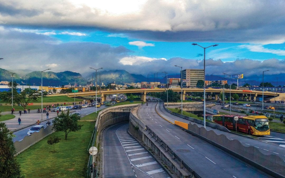
Bogotá, Colombia, is home to 7.1 million residents, a megacity attempting to respond to problems faced throughout the global south, most notably income inequality and spatial injustice.
Context
TransMilenio, established in the early 2000s, was Bogotá’s first step to reorganize an inefficient, privately owned public transit system. Wages, labor, maintenance and fares were restructured to be more symbiotic, with intent to establish a stable system without flux of bus fares and wages.


1 Year
We extend the web of transit lines to reach peripheries like the one pictured above with micro-transit systems such as bikes, scooters or shuttles. An app, when advertised amply, can help users connect the bike/scooter system to cable-car and bus transit lines.

10 Years
Within 10 years, develop infrastructure around existing nodes, slowly increasing the number of routes in parallel, which expands the reach of transit systems. Investment in streetlights and sidewalks improve accessibility of transportation hubs.

30 Years
Bogotá would achieve an interconnected transit map, something that they are already developing with feeder routes and the TransMiCable gondola system. Transit nodes would expand beyond one branch leading to another — each branch would lead to many interconnected routes, with a variety of modes of transportation.
